Assets > Callan Coking Coal
Callan Coking Coal
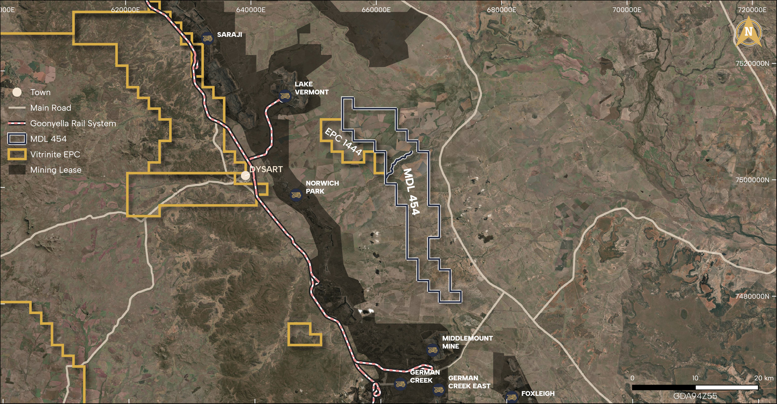
Vitrinite has purchased MDL454 and EPC1444, forming the expansive Callan Coking Coal. This promising venture is nestled between Middlemount and Lake Vermont operations, covering 231 square kilometres and is approximately 27 km from Dysart.
Seams present in the existing drilling include Leichhardt, Vermont, and Girrah. Minor plies of the PH (upper Rangals) are also present. The tenement presents higher rank coal that is faulted along regional north-south striking reserve faults. Other normal faults are known in the area.
Location
The project is 231 square kilometres and approximately 27 km from Dysart. The tenement area sits between Middlemount & Lake Vermont operations.
Nearest Port
Dalrymple Bay and Gladstone.
Rail Line
Goonyella and Blackwater.
Mines in Region
Lake Vermont, Middlemount, German Creek, Foxleigh.
Coal Type
PCI and Coking Coal.
Method
Open Cut, Terrace.

Geology
Located on the Collinsville shelf on the central western margin of the Bowen Basin.
Callan Coking Coal is situated on the eastern edge of the Bowen Basin within the geological feature known as the “Bee Creek Syncline.” It is distinguished by north-easterly dipping strata and exhibits signs of compressional structural deformation.
The overarching structural features in the region are primarily characterised by the north-northwest trending Jellinbah and Foxleigh thrust faults. The Jellinbah fault aligns with the western perimeter of the Project, while the Foxleigh fault corresponds to the eastern boundary of the Project. In the region, the Rangal Coal Measures (RCM) and upper Fort Cooper Coal Measures (FCCM) host four primary coal seams: the Phillips, Leichhardt, Vermont, and Girrah Upper seam. Beneath the RCM, a variety of other seams have been encountered within the FCCM, but these seams are extensively interspersed with stone bands.


